Located in the southern Gore Range at an elevation of 10,662 feet, Vail Pass has been the site of periodic human occupations for at least 8,000 years. The prehistoric camp probably served as a high-altitude base when the growing population of nearby Native American groups caused them to expand their area of resource use. In 1940 a paved highway was completed over the pass, which was named for state highway engineer Charles Vail. In the late 1970s that route was upgraded to Interstate 70.
Early Roads
Although it is now an important landmark along Interstate 70, before the 1930s Vail Pass lay in the middle of a seemingly impenetrable mass of mountains. No railroad route went anywhere near there, and the earliest automobile roads west from Denver turned either north to Steamboat Springs or south to Leadville to avoid going through the Gore Range.
The Vail Pass area started to become less remote in the 1920s, when boosters in Red Cliff and other mountain towns began to push the State Highway Department to construct a “Holy Cross Trail” along roughly the same path that I-70 would later follow. Designed to deliver pilgrims to Red Cliff as a base for visiting nearby Mount of the Holy Cross, the route was supposed to provide a more direct route by going over Shrine Pass (near present-day Vail Pass) instead of curving south toward Leadville.
The State Highway Department endorsed the Holy Cross Trail but never made it a priority for funding. In 1931 a dirt road was built to Red Cliff via Shrine Pass, but it was never paved. In 1940 Vail Pass finally came into being when the state used Public Works Administration funding to construct a paved road over the pass between West Ten Mile Creek and Black Gore Creek. This two-lane road became the route of US 6 through the mountains. It also gained a reputation as one of the state’s trickiest drives, with long straightaways suddenly giving way to dangerous turns. Most traffic headed west from Denver continued to follow US 40 through Steamboat Springs to Utah.
Interstate 70
Despite being less popular than US 40, the relatively direct US 6 route was selected in 1960 as the path I-70 would take through the mountains. Initially, interstate planners hoped to eliminate Vail Pass from the route and save ten miles for motorists by blasting a tunnel under the Gore Range near Red Buffalo Pass. This would have required removing land from the Gore Range-Eagles Nest Primitive Area (later Wilderness), however, and public protests in the late 1960s caused officials to abandon the plan and stick with the Vail Pass route.
The plan for I-70 over Vail Pass was subject to years of studies, public comment, and redesigns. It was during this period, in November 1974, that the Vail Pass Camp archaeological site was first tested by Bill Briggs, Curtis Martin, and Doug Dykeman during a survey of the area. The Federal Highway Administration and the Colorado Department of Highways provided funding for a thorough excavation conducted over twelve weeks from August to October 1975. A comprehensive report about the site and the excavation was published in 1981.
Meanwhile, the interstate over Vail Pass was completed in 1978. With its east and west lanes divided by a large natural median and the road elevated on a viaduct in some places to avoid carving into unstable slopes and stream beds, the Vail Pass portion of I-70 looks distinctly different from the rock-blasted interstate corridor farther east. At the summit of the pass, right next to the location of Vail Pass Camp, an exit provides access to a rest area, the dirt Shrine Pass Road, and two fishing lakes that were built on Black Gore Creek just north of the pass. Early plans called for the rest area to include an interpretive display about the archaeological site, but the display was never developed.
Today
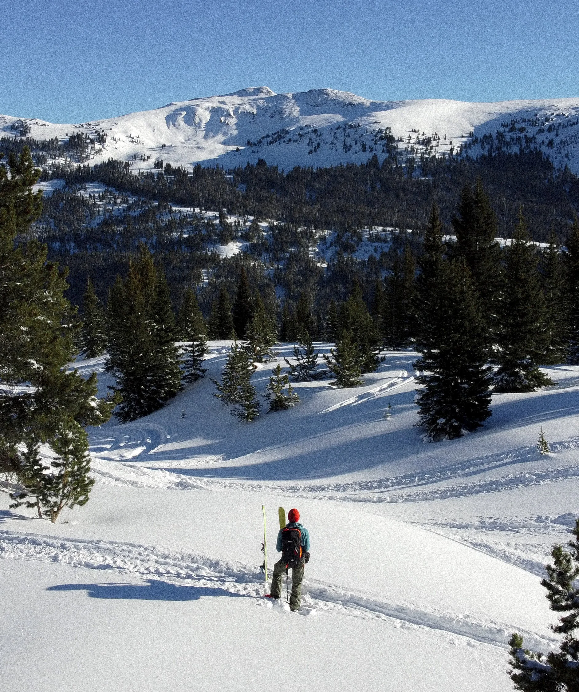
Aside from its continued use as a major transportation corridor, Vail Pass has become a popular site for year-round recreation. During the summer cyclists can follow the paved Vail Pass bike path between Copper Mountain and Vail; for several miles near Vail the path runs along the route of old US 6. Vail Pass can also be used as a trailhead for hiking and is home to fishing at the two Black Lakes, which are stocked with trout. In the winter the pass is a major access point for the 55,000-acre Vail Pass Winter Recreation Area, which contains more than 100 miles of backcountry trails for snowmobiling, skiing, snowboarding, and snowshoeing.
According to Chuck Ogilby, former President of the Vail Pass Task Force, multi-use conversations among a group of concerned users in the Vail Pass area began in 1989 or 1990. "The area at the time was being used by many users. A heli-ski operation, a snow-cat operator, several private snow-cat clubs, snowmobiles, snowmobile guides and outfitters, four Tenth Mountain Division backcountry huts, nordic ski guides, and independent backcountry users both motorized and non-motorized. This intense use was chaos. But the use then was a fraction of what it has become today."
The group organized, and by the mid-nineties the Vail Pass Task Force had become a 501 c3 corporation. "For many years the Task Force tried to operate the area under a voluntary sharing (and separated) use plan. This, however, received little compliance from users. After years of frustration, and limited successes, the Task Force asked the Forest Service to implement a Fee Demo area as a last straw to manage the area so that all (motorized, non-motorized, and hybrid) user interests are satisfied." (a hybrid user is a motorized machine towing or hauling a non-motorized user to an area of open ski terrain with motorized trail access)
The Fee Demo program was approved by the Forest Service in about 1997 and was the first such experiment over snow in the United States. The management of this newly formed Vail Pass Winter Recreation Area became formally managed as a partnership between the Forest Service and the citizen advisory board, this Vail Pass Task Force. The Task Force is now made up of 8 Board Members, four motorized and four non-motorized with hybrid use being represented by both. A quorum of all 8 members must be present to conduct business.
"The mission of the motorized user is to have marked, groomed, looped trails and designated play areas. For the non-motorized user the mission is to have designated, trackless, quiet areas and trails in which to seek enjoyment. The hybrid user needs motorized access to designated non motorized play areas. We believe these objectives are being met better and better every year.
It costs a great deal of money to administer both sides of this complex equation." The Task Force and the Forest Service work hard to balance the use of the collected monies to apply equally to all the users. The fee program provides guidance to all winter recreationists visiting the Vail Pass area. Maps are distributed, showing the designated areas/trails for motorized and non-motorized use. Fifty-five miles of motorized trails are groomed, boundaries are marked with well placed signs, and patrolling rangers issue warnings and tickets when established boundaries are ignored, or fees are not paid. Working together, users of all types can now enjoy the Vail Pass area.